
Lower Danube
Bulgaria
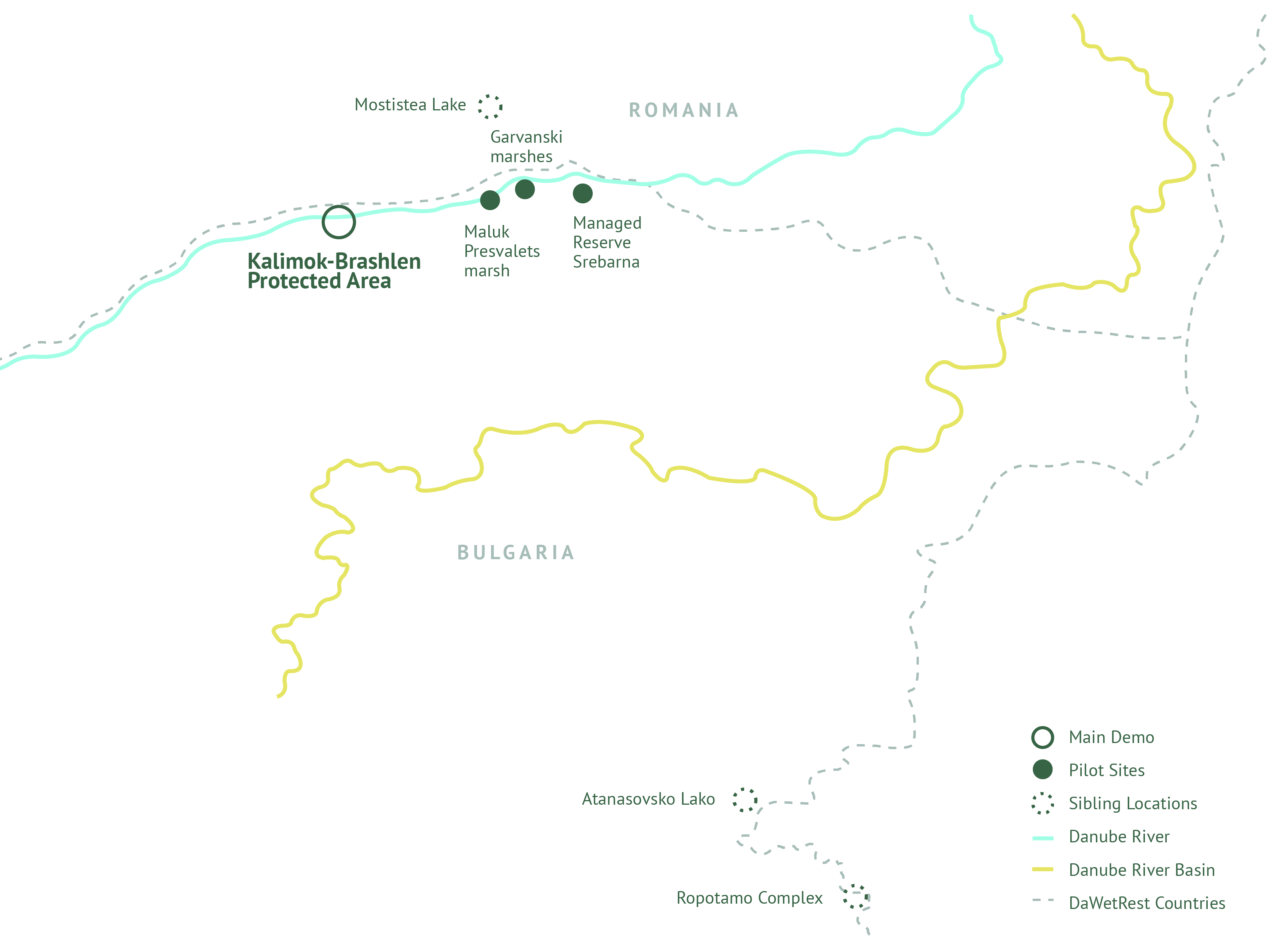
The main location of the LD Demo is Calimok-Brashlen Protected Area (CBPA) bordering the Danube river in Bulgaria. The area consists of 4 zones: Heartland area; Biodiversity management area; Area for sustainable use; Zone for tourism and Infrastructure. An object of observation will also be several sibling sites in Bulgaria like Srebarna lake and Ropotamo complex which are recognized as wetland zones with international importance according to the Ramsar Convention on the wetlands.
In the past, the Kalimok and Brashlen marches were completely flooded, as well as the lowlands along the river’s coast. The territory was mainly used for fishing and animal husbandry. In 1952, the drainage of the Danube marshes began. The direct connection with the Danube was cut off and a system of dykes (started in 1945) and drainage canals were built. A large part of the flooded land has been converted into arable land. Part of the former marches were preserved as wetlands, without a direct connection to the Danube River
Main DEMO location
Kalimok-Brashlen – Natura 2000 Site of Community Importance (SCI); Special Area of Conservation (SAC) in Bulgaria.
Pilot locations
Maluk Preslavets marsh
Garvanski marshes
Managed Reserve Srebarna
Sibling locations
Ropotamo complex
Atanasovsko Lake
Mostistea Lake
Srebarna
Actions

Intelligent freshwater monitoring and management in KBPA for floodplain a biodiversity restoration with open interfaces for data exchange

Development and deployment of a mobile multiparameter measuring station and river research drone for water quality assessment at marches and remote places; (SCORTEL)

Modelling the terrain of inland canals/GIS-geodesy/3D mode; (RUNI)

Piloting tidal power generator to the restoration activities; (RUNI)

Pilot deployment of an automated operation of the 3 locks at the site of Kalimok-Brushlen and integration in intelligent freshwater monitoring and management system.
Findings

Intelligent freshwater monitoring and management architecture

Coastal integrity and resilience testing

Reduction of risk of floods and droughts
Challenges
- Insufficient research, ecological management and monitoring capacities, which results in lack of data on the initial ecological conditions (water balance and cycles, climate patterns, water quality, water discharge and water velocity measurements, vegetation, soil, climate etc.);
- Anthropogenic pressures and environmental interventions, e.g., regulation of the river bed through dykes’ and canals’ construction, which significantly decreased the size of the wetlands and negatively affected the area’s biodiversity;
- Insufficient funding for maintenance and upgrading of the hydrotechnical equipment;
- Conversion of the wetlands into arable land;
- Insufficient involvement of the local communities in activities and trainings for nature protection and revitalization;
- Insufficient efforts (on national level) for floodplain’ restoration based on their importance for the economic life and the society as a whole;
- Necessity of finding out climate neutral and intelligent scientific, societal and technological solutions for floodplain restoration.
Innovative Solutions

Automated Operation of Locks

Ponton power generator
